
Blue carbon credits: from coastal ecosystem to defensible claim
Original synthetic editorial scene. A synthetic editorial view of mangrove, marsh and seagrass habitats beside a field-research notebook; it is not a photograph of a named carbon project. Ecological shapes, connectors and a readable evidence path convey the explanation beyond labels.
Diagram text description
Blue carbon credits are not simply tonnes of carbon sitting in a mangrove forest. They are units issued under a particular programme after an eligible coastal project has measured a net climate benefit, documented its baseline and monitoring, and undergone the required independent review. A company considering a purchase needs to know which ecosystem and activity generated the claimed benefit, what was counted, and whether the exact units were issued and later retired.
That distinction matters because the visual story of coastal restoration is compelling. A thriving wetland can store carbon and support local livelihoods, yet those observations alone do not establish how many tonnes of carbon-dioxide equivalent a project may claim. Restoration, avoided loss, carbon storage and a buyer's public statement sit at different points in an evidence chain.
This guide follows that chain from coast to registry. It focuses on coastal blue carbon, including mangroves, tidal marshes and seagrass. It does not assume that every ocean activity, protected shoreline or planted seedling qualifies for crediting. Programme rules and methodology versions differ, so a real transaction should be checked against the current documents for the named project.
What blue carbon actually covers
“Blue carbon” is the carbon captured and stored by ocean and coastal systems. In the established coastal context, the most familiar habitats are mangrove forests, tidal salt marshes and seagrass meadows. Their plants take up carbon, while waterlogged sediments can hold organic carbon over long periods. NOAA's explanation of these ecosystems is a useful starting point for the physical science. It is not, by itself, a calculation of creditable removals for a particular site.
The habitat boundary matters. Mangroves are trees rooted in coastal wetlands; marshes are tidal vegetated systems; seagrass grows underwater in shallow coastal areas. They differ in hydrology, sediment, land use, disturbance and available measurements. A project method written for tidal wetland restoration cannot automatically be applied to an unrelated open-ocean intervention merely because both are labelled “blue.” Ask for the specific ecosystem, map and intervention before reading a marketing claim.
The two concepts are deliberately not connected by a conversion arrow. Eligibility, baseline, monitoring, characterisation and programme decisions are required to establish credited change. No hectares-to-credits factor is supplied.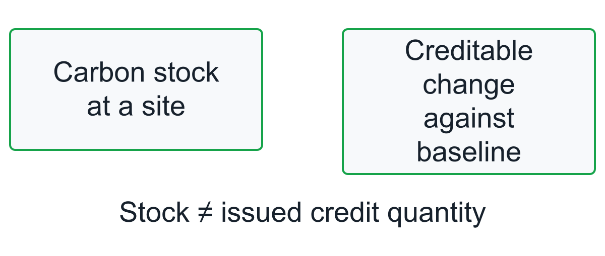
Diagram text description
Carbon stored in a place is a stock. A carbon credit represents a quantified change against an eligible baseline under a specified programme. Preserving an old stock, increasing a stock through restoration, and preventing a future release can produce different accounting questions. For the buyer, the useful first test is whether the seller can explain that difference in plain language and point to the project method that supports the claimed unit.
Picture two sites with the same mapped area but different water flow and disturbance history. Their existing carbon stocks, likely future changes and feasible interventions may differ substantially. Area is useful for defining the project, but it does not supply those missing facts. This is why a map can establish where a proposal operates without establishing a credit quantity.
Restoration and protection start with different baselines
A restoration project improves a degraded coastal system: for example, re-establishing tidal exchange, restoring native vegetation or recovering seagrass habitat where conditions allow. Its baseline describes what would happen without the intervention, and its monitoring measures changes attributable to it. A protection or avoided-loss project instead argues that a credible threat would have reduced an existing carbon store or caused emissions. Avoided loss therefore depends heavily on evidence that the threat and its counterfactual are real.
These pathways should not share an assumed carbon factor. A restored marsh can accumulate biomass and sediment carbon over time, whereas an avoided-loss claim asks whether destruction would otherwise have occurred and how much release was prevented. The activity must fall within the exact programme and methodology used. Verra's VM0033, for example, addresses tidal wetland and seagrass restoration under its stated version; it is not a universal licence for all blue-carbon proposals.
The arrows show qualitative comparisons, not measured growth curves or equal credit quantities. The threatened-loss baseline needs evidence; a restoration methodology cannot be assumed to cover every protection proposal.
Diagram text description
Ask the project developer to name the activity, eligible land and monitoring period before comparing advertised unit volumes. If the seller moves between “protected,” “restored” and “removed” without showing how the baseline and method change, pause. The right comparison is not how attractive two coastal photographs look, but how each project's documented counterfactual, intervention and monitoring produce its claimed net benefit.
As checked on 29 October 2026, Verra lists VM0033 version 2.1 as active and a major revision as under development. Its listed resources also address sea-level risk and landward migration. A proposed revision is not automatically the governing method for an existing project. Match the project's applicable version and programme transition rules instead of taking the newest search result as the calculation basis.
Check who controls the coast and the carbon rights
Before discussing tonnes, identify the project area and who has authority to act there. Coastal boundaries may intersect public land, private rights, fisheries access, community use and changing shorelines. A mapped polygon alone does not establish ownership of the carbon attribute or permission to restore, manage or monitor the site. The developer should show the applicable tenure, permits, agreements and responsibilities for the intervention proposed.
This is also a durability question. If the organisation credited with restoring a wetland cannot maintain water flow, manage competing uses or access the area for monitoring, the expected carbon outcome is less secure. Rights can be shared or contested; local people may bear costs or receive benefits. The buyer should ask whose consent was required, how grievances are handled and whether the governance arrangement lasts through the crediting and monitoring periods. Social safeguards deserve their own evidence, not a sentence added after the carbon calculation.
The conceptual boundary joins tenure and carbon rights with permissions, access and community arrangements. It is not a site map or proof of consent. Monitoring access and duration remain part of the supporting documents.
Diagram text description
A practical review starts with three documents: a project map that matches the registry record, a rights-and-responsibilities summary, and evidence of community engagement appropriate to the site. Trace any change in area or management authority through later monitoring reports. A project may still be worthwhile if a document needs clarification, but the buyer should not assume that a tonne attached to disputed or undefined coastal rights is ready for an unqualified public claim.
Read the net-benefit comparison without inventing a universal equation
A net climate result compares the eligible project outcome with its baseline under a particular methodology. It is not the gross stock found on the coast. The method determines the carbon pools, greenhouse gases, monitoring period, measurements and treatment of uncertainty, leakage and other adjustments. Those choices can affect both the amount and the interpretation of the result.
For restoration, ask what would happen to the degraded site without the intervention and what changes after it. For avoided loss, ask what evidence supports the threatened loss and the intervention's effect on it. A growing stock and a prevented release can both be relevant climate outcomes, but they are not interchangeable measurements. The project must establish the applicable pathway rather than borrow whichever description produces the largest number.
Do not add unlike quantities. Tonnes of elemental carbon, tonnes of CO2 and tonnes of CO2e are different measures; greenhouse gases may require gas-specific characterisation before combination. Hectares, seedlings and habitat-quality scores are not emissions units at all. If a summary jumps from these inputs to credits, ask for the transformations in the monitoring calculation instead of filling the gap with a generic coastal factor.
This is a methodological requirement, not a universal net-credit equation. Elemental carbon, CO2, other gases and CO2e are not interchangeable raw units. The applicable method controls characterisation, baseline comparison, leakage, uncertainty and deductions before verified results and issuance.
Diagram text description
Additionality and leakage also need their own analysis. A project already required or expected without credit revenue raises a different baseline question from one enabled by that revenue. A restriction that displaces damaging activity elsewhere may change the net outcome. The fact that a habitat is valuable does not decide either question.
Read one monitoring period from start to finish: the mapped area, applicable method, baseline, included pools and gases, measurements or models, uncertainty treatment and required adjustments. Then compare the verified result with the programme's issuance record. The figure in a design forecast may differ from what was later verified or issued for sale. This article deliberately supplies no universal blue-carbon equation; the useful test is whether the project's own calculation exposes every necessary transformation.
Coastal carbon can reverse
Coastal carbon storage is exposed to physical and management risks. Storms, erosion, altered sediment supply, land-use change and sea-level rise can damage habitat or release stored carbon. That does not mean every coastal project will fail, nor that every disturbance releases the entire credited quantity. It means the methodology and programme need a credible way to assess reversal risk, monitor the site and respond if the expected benefit changes.
Examine the monitoring horizon and who pays for it. A project can show an impressive planting year and still have too little information about survival, hydrology or sediment over time. Ask what the monitoring plan measures, how often it is updated and whether the project's crediting rules require a buffer, insurance, replacement units or another response to reversals. The precise treatment is programme-specific; no general article can promise that a particular risk mechanism makes a unit permanent.
Storm, erosion or management change triggers investigation, not an assumption that all carbon was released. Monitoring determines what happened; programme rules determine required treatment. A buffer is not itself field measurement or a guarantee of permanence.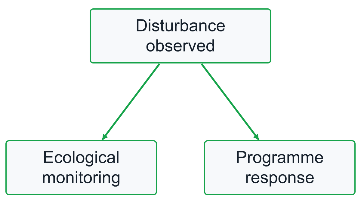
Diagram text description
For a buyer comparing projects, the relevant question is not whether one coast looks resilient today. It is whether the credited benefit remains supported after plausible changes in climate and local management. Inspect the newest monitoring and verification records, not only the original project design. If there is a material storm, erosion event or management change, ask how the project updated its carbon accounting and whether the registry record reflects the outcome.
A change in shoreline position can also affect the project area. The monitoring record should explain how the applicable method treats that change rather than assume the original polygon remains ecologically unchanged. A buyer need not perform the coastal modelling personally, but should be able to locate the current risk assessment and understand which event would require an updated response. A buffer mechanism and a plan to monitor habitat answer related but different questions.
Do not turn every co-benefit into a carbon claim
Healthy mangroves, marshes and seagrasses can provide more than carbon storage. Depending on the place and evidence, a project may improve habitat, support fisheries, reduce some coastal hazards or create work for local communities. These benefits are reasons to investigate a project, but they are not interchangeable with its verified greenhouse-gas quantity. A carbon methodology may quantify tonnes of CO2e without independently verifying every biodiversity or livelihood statement in a brochure.
Keep claims in separate columns. One column records the climate outcome: baseline, project change, method, uncertainty and issued units. Another records ecological indicators such as habitat condition or species. A third records social arrangements: consent, access, employment, benefit sharing and grievances. A positive entry in one column does not fill a blank in another. This is especially important when a project markets “premium” credits on the strength of unspecified co-benefits.
The separate lanes are not additive components or a scoring system. Climate quantity, habitat outcomes and community arrangements each need appropriate indicators and evidence; a carbon unit alone does not certify every co-benefit.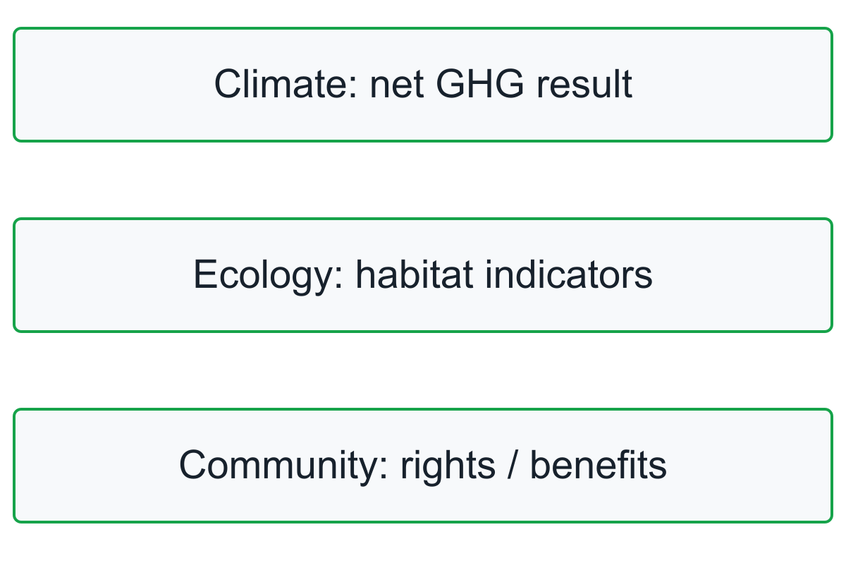
Diagram text description
Ask which claims were independently assessed, which came from project monitoring and which are plans rather than observed outcomes. If a community benefit is material to the buying decision, put its indicator and evidence in the purchase review. A careful statement can acknowledge a credible ecological outcome without implying that the carbon credit alone certifies it. The project may be valuable for multiple reasons, but each reason deserves the right proof.
Follow the unit from verification to retirement
A credible blue-carbon unit moves through several distinct stages. The developer proposes an activity under an applicable programme and method. The project design is assessed; monitoring then records performance over a period; an independent reviewer examines the reported outcome as required; the programme may issue serialised units in its registry. A buyer can then acquire a unit, and a use or compensation claim generally requires the relevant retirement or cancellation evidence.
Do not compress those stages into one word such as “certified.” A project listed on a registry may not yet have issued units. A validated design is not proof that a later period delivered the forecast quantity. A verification report can support issuance, but the buyer still needs to check whether the offered serials exist, are owned by the seller and have not already been retired. Future-delivery agreements should be described as such rather than as a completed purchase of issued units.
Record the programme, project identifier, method and version, monitoring period, verifier, serial range and transaction status. Match these identifiers across the offer, contract, report and registry. If the seller supplies only an attractive project summary, request the exact unit trail. Only the unit-level trail tells the buyer what it can responsibly say after purchase.
A practical buyer evidence packet
The fastest serious review is a packet of documents for one named project and one proposed unit range. It should let a technical reviewer trace the climate calculation and a commercial reviewer trace rights and ownership. The checklist below is a screening tool; the current programme's full requirements remain controlling.
Table 1: scroll horizontally if needed.
| Buyer question | Evidence to request | Pause if missing |
|---|---|---|
| What exactly is the project? | Registry ID, mapped area, activity and method/version | A brochure substitutes for a defined boundary |
| Who may act and claim? | Tenure, permits, carbon rights and community agreements | Rights or access are unclear |
| What changes without the project? | Baseline and additionality demonstration | Counterfactual is only asserted |
| How many net tonnes were measured? | Monitoring report, pools, emissions, uncertainty and deductions | Hectares are treated as issued tonnes |
| What could reverse the result? | Risk review, monitoring plan and programme response | There is no current response to disturbance |
| Which units are offered? | Verification, issuance, serials, ownership and retirement status | Future or previously used units are represented as available |
Read the packet as a chain. The mapped area in the method should match the rights documents; the monitoring period should match the verification; the serials in the contract should match the registry. Escalate a material mismatch rather than filling it with assumptions. A project may pass a basic ecological plausibility test and still fail the narrower test for an offered, claimable carbon unit.
Reconcile offered units before making a buying decision
An illustrative seller shows a holding of 1,000 issued units. Of those, 300 are recorded as retired, 200 have been transferred to another owner and 500 remain in the seller's current holding. The arithmetic reconciles the original batch: 300 + 200 + 500 = 1,000. It does not establish that all 500 remaining units are unencumbered, eligible for this buyer or available under the proposed contract.
Table 2: scroll horizontally if needed.
| Status in the fictional batch | Units | What the buyer can infer |
|---|---|---|
| Retired | 300 | Not a remaining transferable holding |
| Transferred to another owner | 200 | No longer this seller's holding |
| Still held by this seller | 500 | Requires ownership, availability and eligibility checks |
The fictional 1,000-unit batch reconciles as 300 retired, 200 transferred and 500 still held. Lengths represent units. The remaining holding still requires availability, ownership and eligibility checks; issuance history alone cannot support an offer of 600 current units.
Diagram text description
An offer for 600 units therefore needs another identified holding or a clearly described future-delivery arrangement. A brochure showing 1,000 issued units cannot by itself support the offer. Match the proposed serial range and current status, and check whether the seller has already contracted the same units elsewhere.
This is transaction reconciliation, not a coastal carbon calculation. The example assumes that the issued units exist; it does not validate the underlying baseline, net tonnes or social safeguards. Those remain separate parts of the project review. It also does not convert the buyer's gross emissions into a lower inventory total.
If the purchase is intended to support a later claim, agree who will execute retirement and which beneficiary and purpose will be recorded. Until that step is completed, describe the actual transaction status. An owned unit and a retired unit give the buyer different evidence, even when their project name is identical.
Choose the unresolved question before choosing the claim
A project can be attractive and still have a specific unresolved issue. Unclear tenure calls for rights evidence; an unexplained result calls for the monitoring calculation; an oversized offer calls for a unit reconciliation. Another coastal photograph does not resolve any of those gaps.
For a first purchase review, use one named project and a defined proposed unit range. The technical review should explain how the intervention becomes a net verified outcome. The transaction review should explain who can transfer the units and how their final use will be recorded. Ecological and community claims need their own supported indicators alongside that carbon evidence.
Keep the company's gross emissions inventory separate from the purchase. Once the relevant retirement and programme conditions are met, choose wording that describes the supported contribution or compensation claim under the applicable framework. If the evidence is still at project design or future delivery, say so. The strength of the story comes from connecting a real coastal outcome to the exact unit and claim, not from making the claim earlier.